WAYANAD
Location: Northeastern Tip of Kerala
Main Locations: Edakkal Caves, Pookot Lake
Languages: Malayalam, Hindi, and English
Best Season: August to May
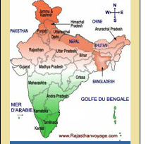
THE SYLVAN VALLEY: Wayanad, One of the fourteen districts in Kerala (India) is situated in an elevated picturesque mountainous plateau in Western Ghats. It lies between north latitude 11degree 26'28'' and 11degree 48'22'' and east longitude 75 degree 46'38'' and 76 degree 26'11''.
Providing a panorama of undulating mist clad hills and dales, Wayanad are blessed with a unique geographical position.
Luxuriant plantations of coffee, tea, cardamom, pepper and rubber are strewn all over the hills of Wayanad. Situated at a height of 700-2100 m above sea level, it is bound on the east by the Nilgiris and the Mysore districts of Tamilnadu and Karnataka respectively.
It shares the borders with Coorg district of Karnataka on the north, on the south with Malappuram district and on the west with Calicut and Cannanore districts. The natural scenic beauty of Wayanad and its rich natural resources offer several opportunities for adventure tourism.
Located at the northeastern tip of Kerala, Wayanad was earlier a part of Kannur district. Panorama, Manathavady and Kabini, the fast flowing rivers lend a unique beauty to the whole region.
PRIME ATTRACTIONS
Edakkal Caves: The two rock caves at Ambukuthy Hills, 12 kms south of Sultan's Battery contain ancient carvings and pictorial writings of the new Stone Age, with human and animal figures in peculiar headdresses along with geometric forms and symbols.
They speak of a highly civilized people at an early center of human habitation. These caves are world famous as one of the earliest centers of human habitation. Situated on the Ambukuthi Hills, the caves can be reached only after trekking 5 kms from Ambalavayal.
Varambetta Moque: 15 kms south east of Kalpetta, this 300-year-old mosque is the oldest in Wayanad.
Ambalavayal Heritage Museum: 12 kms south of Sulthan Bathery, it is one of the best heritage museums in Kerala. The exhibits here include rare 2nd century artefacts such as clay sculptures; ancient hunting equipment’s like bows and arrows, stone weapons and other curios.
Pookot Lake: With its own dream-like serenity, this natural fresh water lake surrounded by meadows and trees on all sides is a haven for peace-loving travelers. It is located half way from Calicut half an hour ahead of Kalpetta.
Kalpetta: This is where the headquarters of the Wayanad District are located. A stronghold of the Jains in the past, the famous Ananthanathaswamy Jain Temple is situated at Puliyarmala near Kalpetta.
Mananthavadi: Historically important as the last resting-place of Pazhassi Raja who fought a guerilla war against the British.
Chethalayam Waterfalls: 12 kms from Sulthan Bathery on the Pulpalli Main Road, is located this astounding waterfall. For a glimpse of this lovely waterfall, one has to trek a distance of around 4 kms from Chethalayam.
Kanthanpara Waterfalls: 12 kms southeast of Kalpetta, it's a small yet scenic waterfall just about 30 m in height.
Tusharagiri: Famous for its trekking tracks, Tusharagiri is located near Vythiri in Wayanad.
Vythiri: Vythiri is a picturesque place located in the sylvan Northern High Ranges of Kerala in Wayanad District. Exclusive, comfortable, refreshing, pollution free and inspiring.
Pakshipathalam: 7 kms north east of Thirunelli, this picturesque bird watching center is located at a formidable height of 1740 m above sea level. With its steep hills, virgin forests and rivulets, it is the habitat of a number of rare species of birds.
It also offers challenging avenues for those interested in trekking. A cave believed to have been used by ancient saints for meditation is a hub of tourist interest.
Sentinel Rockfall: Near Chooralmala, about 22 kms south of Kalpetta, it is a riveting waterfall tumbling down a height of 20 m from a hilltop. The spot is ideal for rock climbing.
Meenmutty Waterfalls: 12 kms east of Meppadi, it is a bewitching waterfall cascading in three tiers, down a spectacular height of 500m.
Soochipara Waterfalls: Soochipara Waterfalls is located 22 kms from Hotel Green Gates. On alighting the vehicle, one can reach the waterfalls after a 2-km walk into the dense equatorial forest of Wayanad.
Valliyoorkkavu Temple: 3 kms east of Mananthavadi, this temple, dedicated to Goddess Durga is very popular among the tribal communities of the district. The ten-day annual festival, which falls in April, is celebration time for the tribals.
Thirunelli Temple: Located 30 kms north west of Mananthavadi in the Wayanad district, Thirunelli Temple is known as the "Kashi of South". Tucked away in the Brahmagiri Hills, Thirunelli Temple is encircled by the gurgling River Papanasini.
Banasura Dam: 15 kms north west of Kalpetta, Banasura Dam is the largest earth dam in India. A vast expanse of crystal clear water bounded by blue hills on all sides, except one. It’s an ideal picnic spot.
Kuruva Island: 17 kms east of Mananthavadi, it stretches over 950 acres of evergreen forests on the banks of Themkabani River. The island is a repository of rare species of birds, animals, orchids and herbs.
Chembra Peak: Chembra peak, which is the highest peak in Wayanad, is located 14 kms west of Kalpetta. Located amidst panoramic surroundings, the peak is at an altitude of 2100 m above sea level.
HOW TO GET THERE
Air: The nearest airport is Calicut.
Rail: The district is well connected by a railway network.
Road: Wayanad's Headquarters, Kalpetta is linked by road to other towns in Kerala and there are frequent buses to Calicut.
NEARBY CITIES
| Kozhikode |
70 km |
Mysore |
140 km |
Ooty |
175 km |
GENERAL INFORMATION
Area: 2,132 sq.km.
Population:671,195
Altitude:700-2100 m above sea level
Climate:Tropical monsoon, seasonally excessive rainfall and hot summer
Temperature:
Mean Min:20°C
Mean Max:35°C
Rainfall:250 CMS (annual)
Clothing:Tropical cottons |