uttarkashi
Location: (155 Kms From Rishikesh) Uttaranchal
Main Attractions: Maneri, Nachiketa Taal
Best Season: May-June, September-October
Languages/Dialects: Hindi, Garhwali
TREKKER'S DELIGHT Uttarkasi is located in the northern part of Uttaranchal. Uttarkasi was originally a part of Tehri Garhwal. But soon after independence, when Tehri Garhwal Kingdom merged with India, it was made a district of the Kumaon division.
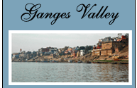
In 1960, it was made a border district with the district headquarters at Uttarkasi. The district is more important because of the two very significant Pilgrimage-centers viz. Gangotri and Yamunotri, the source of the two rivers, Ganga (Bhagirathi) and Yamuna.
The major locations of the district are Dunda, Puroia, Rajgarhi and Bhatwari. Major tourist attractions are Chaurangi Khal, Bhairon Ghati and Gangotri. Yamuna, Rupin and Bhagirathi Rivers flow through the district.
PRIME ATTRACTIONS
Govind Wildlife Sanctuary: Situated amidst the lush green meadows of the Uttarkasi district, the most beautiful part of the Garhwal region with its magnificent snowballed peaks and glaciers, the sanctuary is spread over an area of 953 sq. kms.
Uttarkasi: Uttarkasi is a regional centre, 155 kms. From Rishikesh and is the administrative headquarters of the district. Several trekking companies operate from here and the town is also the base for the Nehru Institute of Mountaineering, where Bachhendri Pal, the first Indian woman to climb to the summit of Mt Everest, was trained. The town is pleasantly situated on the banks of the Bhagirathi River, drawing pilgrims to its Vishwanatha Temple, sacred to Shiva.
Nachiketa Tal: Situated between Panchangaon and Fold Gaon, this beautiful lake is perennially filled with water. There is greenery all around and a small temple at the bank of the lake gives a serene look to the location.
Maneri: On way to Gangotri at a distance of about 13 kms. From Uttarkasi, Maneri has lately emerged as a place of tourist interest as a result of the construction of a dam across the Bhagirathi River, from where the water is fed to the turbines through an 8 kms. Long tunnel at Tiloth in Uttarkasi.
Gangnani: Gangnani, about 37 kms. From Maneri, is the hot water spring at Gangnani where one can have a refreshing bath?
Dodital: Situated in the midst of deodar, cheer and bamboo forests, Dodital is situated at an elevation of 3307 meters. The water of the lake is sparkling and crystal clear. The famous Himalayan trots are found in abundance in the lake.
Dayara Bugyal: Bugyal in the local language means “high altitude meadow”. Situated at an elevation of about 10,000 feet above seal-level this vast meadow is second to none in natural beauty. During winter, it provides excellent ski slopes over an area of 28 sq. kms. The panoramic view of the Himalayas from here is breathtaking. There is a small lake also in the area, and to camp by its side would be memorable event.
Harsil: The Bhagirathi valley is most enchanting and preserves many colorful spots in its lap. Situated at a distance of 72 kms. From Uttarkasi on the main highway to Gangotri, at an elevation of 2623 meters, this sylvan hamlet is famous for its natural beauty and delicious apples.
Sat-Tal: Sat-Tal meaning seven lakes is situated just above Dharali, 2 kms. Beyond Harsil. The trek of about 7 kms is rewarding as this group of lakes is situated amidst beautiful natural surroundings. It also provides lovely camping sites.
Bhairon Ghati: On way to Gangotri, Bhairon Ghati is a place where one can stay and enjoy the mountainous landscape. A temple of Bhairon here is visited by scores of pilgrims. The awe-inspiring lofty peaks, deep gorge of Jahnavi and Bhagirathi rivers and the towering deodar trees provide a rare natural bonanza.
Gangotri: The shrine of Gangotri situated at an elevation of 3200 meters above sea level, amidst captivating surroundings is 100 kms. From Uttarkasi. The temple, constructed by the Gorkha general, Amar Singh Thapa in the 18th century, is situated on the Right Bank of Bhagirathi. It is visited by Lakhs of pilgrims every year. A number of ashrams are located on the other side, some of which provide accommodation facilities to the visitors.
Kedartal: This spectacular and enchanting lake is situated at a distance of about 18 kms. From Gangotri, negotiable through a rough and tough mountain trail. The lake is crystal clear with the mighty Thalaysagar (Sphatiklin) peak forming a splendid backdrop.
Gaumukh: The Gaumukh glacier is the source of Bhagirathi (Ganga) and is held in high esteem by the devotes who do not miss the opportunity to have a holy dip in the bone chilling icy water. It is 18 kms. From Gangotri.
Nandan-Van Tapovan: These two spots are situated opposite the Gangotri glacier further up from Gaumukh, at a distance of 6 kms. From where visitors can have a superb view of the majestic shivling peak.
Yamunotri: The shrine of Yamunotri, source of river Yamuna is situated in the direction opposite to Gangotri and the road bifurcates and goes to Yamunotri from Dharasu, a place between Rishikesh-Uttarkashi. Situated at an elevation of 3235 meters above sea level, the shrine of Yamunotri is one of the ‘four dams’ of Uttarakhand.
Har-ki-dun: Har-ki-dun is famous for its natural beauty and is a popular destination for trekkers.at the height of 3566m; Har-Ki-Doon is a land of unparalleled beauty in the whole district of Uttar Kashi.
White Water Rafting: Rafting is done on river Bhagirath.
Kush Kalyan, Belak Khal Range: About 16 kms. From Malla, which is 28 kms. From Uttarkasi on GANGOTRI Road, the meadow of Kush-Kalyan is situated at an elevation of 11000 feet. Further west, it extends up to Chaurangi-Khal. Trekking along this range is an enjoyable experience. During winter, all these places provide vast expanse of ski-slopes.
HOW TO GET THERE
Air: No direct air link.
Rail: No direct rail connection.
Road: The district is well connected by road.
Local Transport: Buses, Taxis, Tempos, and Auto-Rickshaws.
GENERAL INFORMATIONTemperature:
Summer:Max: 23 oC; Min: 9 oC
Winter:Max: 8 oC; Min: 2 oC
Clothing:
Summer:Light Woolens.
Winter:Heavy Woolens. |