khasi hills
Location: Meghalaya
Comprise Have: West Khasi Hills & East Khasi Hills
Tourist Attractions: Shillong
Best Time To Visit: September To May
The District: West Khasi Hills, presently the largest district of Meghalaya, was carved out of the erstwhile Khasi Hills District on the 28th October 1976. In the same year, on 10th November, the Mairang Administrative Unit was upgraded into a full-fledged Sub-Division and Mawkyrwat was created as an Administrative Unit.
The Khasi Hills District was divided into two districts, viz the East Khasi Hills District and the West Khasi Hills District on 28th October 1976. On June 4th, 1992, East Khasi Hills District was further divided into two administrative districts of East Khasi Hills District and Ri-Bhoi District.
Shillong is the district headquarters of East Khasi Hills District. The district consists of seven Community and Rural Development blocks at present.
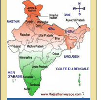
Area And Location: The West Khasi Hills District lies in the central part of the State of Meghalaya and is situated between approximately 25° 10' and 25° 51' N latitude, and between 90° 44' and 91° 49' E longitude. It is bounded on the northwest by Kamrup district of Assam, on the northeast by Ri Bhoi district, on the east by East Khasi Hills district, on the south by Bangladesh, on the west by East Garo and South Garo Hills districts.
The district comprises an area of about 5,247-sq-kms, which is 23% of the total area of the state. Nongstoin, covering an area of about 76.00-sq-kms, is the Headquarter of the West Khasi Hills District.
East Khasi Hills District forms a central part of Meghalaya and covers a total geographical area of 2,748-sq-kms. It lies approximately between the north latitude 25° and 25°45´ and between east longitudes 91°15´.
The northern portion of the district is bounded by the plain of Ri-Bhoi District gradually rising to the rolling grasslands of the Shillong plateau interspersed with river valleys, then falls sharply in the Southern portion forming a deep gorges and ravines in Mawsynram and Shella-Bholaganj, community and rural development block, bordering Bangladesh. The Jaintia Hills District bound the district to the east and the West Khasi Hills District to the west. The Khasis are predominant inhabitants of the East Khasi Hills, though Garos and others are found in the southern border areas.
Physical Features: The West Khasi Hills district is divided into four broad geographical units. There is the Western sector with dense forest with an elevation of 600 to 900m, bordering the Garo Hills. In the Southern sector, especially the southeastern part, the hills slopes rather abruptly to an elevation of about 150m, close to the plains of Bangladesh. In the Northern sector, there are a series of hills and ranges which gradually slope down to an altitude of about 150m till they each the plains of Assam. In the central sector, the hill ranges run parallel from East to West forming the highest part of the district with an average altitude of about 1,400m.
The East Khasi Hills District is mostly hilly with deep gorges and ravines on the southern portion. The most important physiographic features of the district are the Shillong Plateau interspersed with river valley, and then fall sharply in the southern portion forming deep gorges and ravine in Mawsynram and Shella-Bholaganj bordering Bangladesh. Shillong peak lying 10-km from the city, offer a panoramic view of the scenic countryside and is also the highest point in the district as well as in the State. In the evening, the city lights below appears like a star-studded abyss.
Hill Ranges: The only hill range of significance in the West Khasi Hills district is the Mawthadraishan range, which runs from east to west. Hilly formations that have potential tourist attraction are the Kyllang Rock, which is formed of a huge igneous rock, located near Nongkhlaw (11-km) from Mairang and Lumsymper, on the northeastern extremity of Mawkyrwat Civil Subdivision. Apart from these, the other major hills are Lum Kyllai-Longsngun at Myriem, 40-km from Nongstoin Lum Iawpaw near Nongnah of Ranikor block, Lum Nongsynrih at Mawkyrwat Block & Lum Iangram near Umsaw Byrki about 20-km from Nongstoin.
CLIMATE: The climate of the West Khasi Hills is mildly tropical in the northern and southern foothills, while in the central upland zone; the climate is temperate and places at medium altitude in the northern, western and southern parts of the district experience sub-tropical climate.
The district is influenced by the South- West monsoon and rainfall is assured during summer, but differs greatly in intensity from area to area within the district. The average rainfall ranges from 1,200 mm to 3,000 mm per annum.
The climate of the district ranges from temperate in the plateau region to the warmer tropical and sub-tropical pockets on the Northern and Southern regions. The whole of the district is influenced by the southwest monsoon, which begins generally from May and continues till September. The weather is humid for the major portion of the year except for the relatively dry spell usually between December and March.
Flora And Fauna: The district is blessed with a rich heritage of flora comprising of Khasi pines in the higher altitude areas and Teak, Sal, Titachap, Gamari and Makri Sal in the lower reaches. Orchids and pitcher plants are also found in certain pockets. However, with the passage of time, owing to the deforestation most of the species have been depleted.
The fauna of the district includes Elephants, Apes, Monkeys, Deer, Sambar, Tigers, Wild Boars, Bears, Leopards and many others. Common birds are Duck, Hornbill, Myna, Pheasants, etc. However, due to poaching and deforestation, the number of wild animals has depleted to a great extent.
PRIME ATTRACTIONS
West Khasi Hills District offers a lot of scope for adventure tourism in terms of trekking, rock climbing, angling and the like. It has a number of peaks to be scaled, bridle paths to be trekked and water ways for canoeing and rafting. Besides, a number of cascades formed along the river courses add to the natural beauty of the district. There are also a number of attractive picnic spots and camping sites.
Ranikor; About 156-km from Nongstoin and 120-km to Shillong is one of the best fishing spots. Anglers can row up the Jadukata river where the Kynshi and Rilang converge and enjoy angling for the huge golden Mahseers, the pride of anglers and other species like the golden carp, silver carp and the common carp are available here. The surrounding rock cliffs and the clear blue water add to the scenic beauty of the place.
Jakrem: Situated 45-km from Nongstoin (via Mawthawpdah) and 59-km from Shillong, has a hot spring of sulphur water, which is believed to have medicinal properties. People can have a dip here and experience a refreshing feeling.
Thum Fall: Thum fall on the river Kynshi that is about 60m high and situated near Sangriang village offers a wonderful sight and can be viewed prominently from Mawpon village. At the base do hard rocks surround a beautiful pool on three sides.
Weinia Fall: Waienia fall on the same river Kynshi and quite near to the Thum fall is another scenic cascade. It is quite deep and water foam rising up from the bottom of the fall in sunlight, form the colours of the rainbow. Both the sides of the falls are surrounded with rocks of different shapes, sizes and colours. Massive step-like structures are also seen on one side of the fall.
Mawthadraishan Peak: Which takes an hour and a half to reach from the Shillong-Nongstoin road, is located on the way to Shillong near Nongshillong village. On top of the range , there is a depression with about 7 to 8 fishponds of considerable size. The apex of the peak offers a panoramic view of the plains of Assam, and the distant Himalayas after the monsoon, on clear days.
Kyllang Rock: Kyllang Rock is made of a single, huge solid igneous rock is situated at Mawnai about 10-km from Mairang, the sub-divisional Head Quarter. The top of the dome-shape rock can accommodate a considerable number of picnickers
Lum Symper: This place is situated a few kilometers from Weiloi village on the way to Mawkyrwat. It is a beautiful picnic spot.
Nongkhnum River Island: A couple of hours trek from Nongstoin is the hitherto little known river island on the Kynshi known as "Nongkhnum". It is in the form of a Plateau with an area of about 25-sq-kms.
Anglers' Delight: Other attractions for anglers are a number of river confluence like the Kynshi-Wahblei, Khri-Khri Synia, Kynshi-Rilang and others which abound in a variety of fish species and afford the amateur angler ample opportunities for a catch and, at times, a good haul of fish.
Trek Routes: The district also has a number of bridle paths, the legacy of the British administrators, which offer good trekking routes for the tourists who love a taste of refreshing, outdoor life and who wish to come close to nature.
HOW TO GET THERE
Air: The nearest airport is situated in Guwahati (Borjhar) in Assam, 124-km away from Shillong.
Rail: The nearest railhead is situated at Guwahati, 100-km away.
Road: One can catch regular taxis and buses from the airport and rail station |